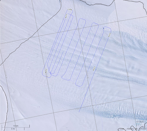
BAS Flights C37 - 2011
Description
In support of a planned drilling campaign on the floating portion of Pine Island Glacier, West Antarctica, two detailed grids of ice-penetrating radar were acquired during airborne sorties in January, 2011. The data presented here is from one of these flights (Flight C37), acquired to allow detailed site selection of optimum drill-sites.
References
1. BAS Ice thickness measurements april 2011 - Polar Airborne Geophysics Data Portal
2. Vaughan, David G.; Corr, Hugh F. J.; Bindschadler, Robert A.; Dutrieux, Pierre; Gudmundsson, G. Hilmar; Jenkins, Adrian; Newman, Thomas; Vornberger, Patricia; Wingham, Duncan J.. 2012 Subglacial melt channels and fracture in the floating part of Pine Island Glacier, Antarctica. Journal of Geophysical Research (Earth Surface), 117 (F03012). 10, pp. Available here .
Figures

Figure 1: BAS flight C37 flight lines overlaying LIMA mosaic. Polar Airborne Geophysics Data Portal, BAS