GPS stations (2010-2011)
Description
A brief period of geophysical data acquisition was completed on Pine Island Glacier in 2010-11. The main goals were to continue a record of monitoring changes in the glacier’s dynamics and to map a region of fine-scale bed topography and internal ice-stratigraphy. GPS receivers were provided by GEF.
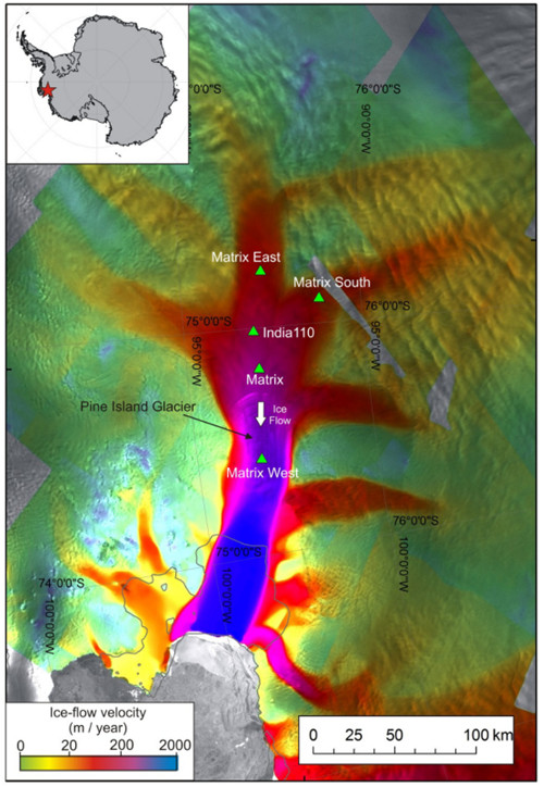
Three GEF GPS receivers were deployed on PIG during the 2010-11 season. Each station comprised a Leica GPS receiver with antenna mounted on an aluminium pole. Power was provided by a 100 Ah sealed gel lead-acid battery with 40 W solar panel and regulator. Sample rate was 10s.
Data recovery was >90%. Data were processed by G.H. Gudmundsson using Bernese PPP software3; positions were calculated at 30 s epochs.
References
1. Measuring changes in the dynamics of Pine Island Glacier, Antarctica. Available Here
Figures

Figure 1: Location map of Pine Island Glacier. Background is satellite imagery, colours show ice flow velocity. Green triangles mark the GPS stations occupied at various times since 2006, including those supported by GEF Loan 927. Andy Smith & E.C. King, BAS