DELORES DEMs 2013-2014
Description
The Deep-Looking Radio Echo Sounder (DELORES) identifies the form and composition of the ice-bed interface. At each main 'radar site' 22 15km radar profiles orthagonal to ice flow were collected. The reflection data was processed and Digital Elevation Models (DEMs) created to visualise derived bedrock.
- Central frequency 3 MHz
- Sampling interval ± 1 metres
- Vertical resolution ± 3 metres
- Spatial Resolution: 50m
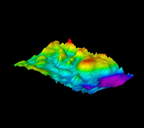
DELORES-derived bedrock DEM (50 m x 50 m) acquired during the iSTAR 2013-2014 traverse. Data provided by BAS.
- Site SB1 (istar07) shows the Pine Island Glacier main trunk bedrock topography.
- Sites SB16 (istar08), SB5 (istar13) and SB7 (istar15) show the bedrock of upstream tributaries to Pine Island Glacier.
- Site SB7R9 (istar17) shows the bedrock of an inter-tributary ridge.
- Site SB9 (istar18) shows the bedrock of a downstream tributary to Pine Island Glacier.
The DELORES DEMs are not currently available for download on the iSTAR GIS directory as it is currently pre-publication, once this data has been published it will be available through the iSTAR GIS download repository.
References
1. The nature and dynamics of the bed beneath Pine Island Glacier, Antarctica - Presentation
2. iSTAR-C: Preperation update
Field photo

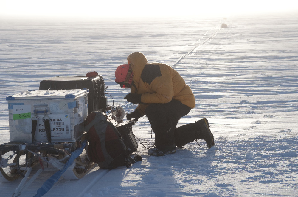
BAS ice radar system (DELORES) used to measure ice thickness and map internal layer in the ice sheet. BAS Image collection (2013/2014) , David Vaughan
Figures

Figure 1: iSTAR site 17 (intertributary ridge) 3D DELORES derived DEM created from mesh of bed picks. This DEM identifies the bedrock surface topography beneath the ice sheet. Bingham et al., 2014