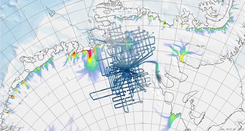
BBAS AGASEA flight ice thickness points (2004-2005)
Description
This data set includes flight point elevation data (ice thickness) from the Airborne Geophysical Survey of the Amundsen Sea Embayment, Antarctica (AGASEA) conducted during the 2004-2005 austral summer.
Investigators derived maps of the ice sheet surface and subglacial topography, which covers the entire catchments of both the Thwaites Glacier and the Pine Islands Glacier, from airborne survey systems mounted on a Twin Otter aircraft. The surveys had sufficient density to identify critical ice dynamic transitions within the Amundsen Sea Embayment (ASE).
References
1. Vaughan, David G.; Corr, Hugh F.J.; Ferraccioli, Fausto; Frearson, Nicholas; O'Hare, Aidan; Mach, Dieter; Holt, John W.; Blankenship, Donald D.; Morse, David L.; Young, Duncan A.. 2006 New boundary conditions for the West Antarctic ice sheet: subglacial topography beneath Pine Island Glacier. Geophysical Research Letters, 33 (9), L09501. 4, pp. 10.1029/2005GL025588. Available Here
2. BBAS Flight lines and data - Polar Airborne Geophysics Data Portal
Figures

Figure 1: BBAS Flight ice thickness (m) points as seen on iSTAR GIS Polar Airborne Geophysics Data Portal, BAS