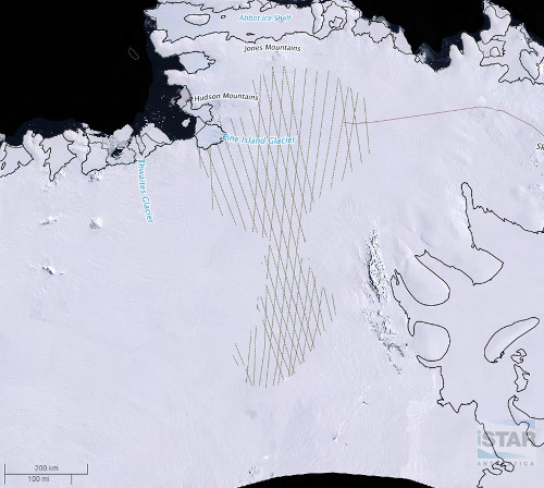
Cryosat-2 ground tracks
Description
CryoSat, a specialist radar altimetry mission was launched in April 2010 and was originally proposed by the 'Centre for Polar Observation and Modelling ' (CPOM). It is dedicated to measuring changes in polar sea ice thickness and the mass balance of the ice sheets of Greenland and Antarctica. Accurately measuring these is an essential part in understanding, monitoring and predicting climate change.
This data shows an example of orbit ground track lines from the CryoSat-2 satellite for Pine Island Glacier's ice feature catchment. Data was downloaded from the ESA CryoSat Data portal:
References
Figure

Figure 1: CryoSat-2 ground tracks overlaying the Pine Island Glacier feature catchment (LIMA mosaic) as seen on iSTAR GIS. iSTAR GIS