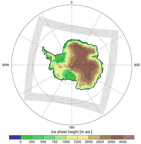
RACMO 2.4 Model
Description
The Regional Atmospheric Climate Model (RACMO2) is developed and maintained at the Royal Netherlands Meteorological Institute (KNMI) (Van Meijgaard et al., 2008).
RACMO2 adopts the atmospheric physics module from the European Centre for Medium-Range Weather Forecasts Integrated Forecast System (ECMWF-IFS) and the dynamical core of the High Resolution Limited Area Model (HIRLAM) (Undèn et al., 2002).
18 flow lines are presented in the data with each point identifying the year when surface elevation rate exceeds 1m/yr according to a simple linear model. Data pre- 1992 are extrapolated back in time as no altimetry mission data exists.
This RACMO raster identifies the 1979-2015 annual mean surface mass balance from the RACMO 2.4 model, at 5.5km resolution.
This RACMO 2.4 dataset was generated and managed by the Institute of Marine and Atmospheric Research (IMAU), Utrecht University, The Netherlands. These data are so far unpublished. Please contact Jan Lenaerts (jtmlenaerts@gmail.com) for more information.
References
RACMO Regional climate model Available here
Figure

Figure 1: RACMO regional model output example of Antarctica identifying Ice sheet height [,. asl.] RACMO Regional Model