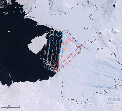
Glacier front positions (2001-2016)
Description
Glacier front positions were digitized using an archive of Landsat imagery (Landsat 7 ETM and Landsat 8) from 2001-2016. Imagery was used for identifying the Pine Island Glacier front when cloud cover did not obscure the main trunk position.
This dataset was created by Jonathan Lee (BAS) in QGIS for the iSTAR project on 07/03/2017.
References
1. Imagery data was downloaded from USGS EarthExplorer: USGS EarthExplorer
2. iSTAR GIS
Figures

Figure 1: Glacier front positions of Pine island Glacier (2001-2016) overlaid on LIMA Mosaic of Antarctica as seen on iSTAR GIS iSTAR GIS