Welcome to the British Antarctic Survey web map services user guide
At British Antarctic Survey (BAS) and within the Mapping and Geographic Information Centre (MAGIC) a series of web map services are hosted and developed for sharing and visualising geospatial data.
These map visualisation sites include:
- Antarctic Digital Database (ADD): http://www.add.scar.org/
- South Georgia GIS : http://www.sggis.gov.gs/
- Antarctic Peninsula Information Portal (APIP) : http://www.add.scar.org/home/apip
- Antarctic Place-names Committee : http://apc.antarctica.ac.uk/
- iSTAR GIS : http://gis.istar.ac.uk/
Each map visualisation provides various tools and features to explore the geospatial data available and this guide provides an in-depth explanation of the various features available on all webmaps.
To view the web map services guide and individual sections please follow the link : Webmap user guide index
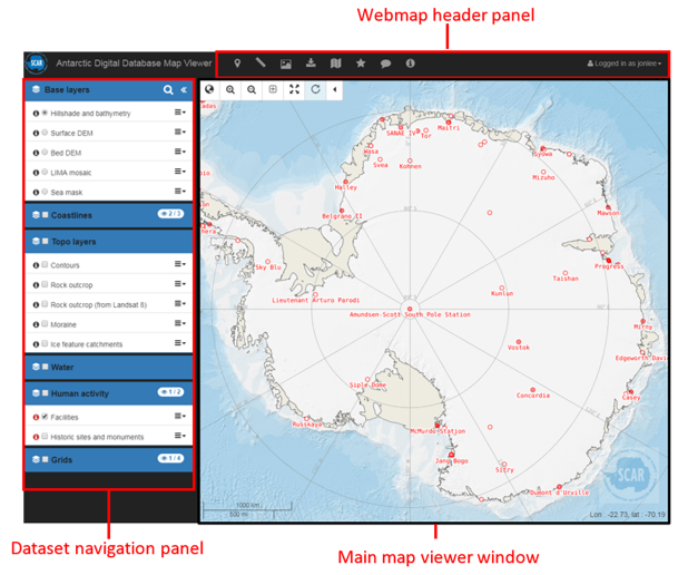
Figure 1 : ADD map viewer with main web map features (header panel. navigation panel, map viewer). ADD
